Client
Real Estate Development
Delivery
June - 2023
Project Type
Location
Aberdeenshire, Scotland
Scope of survey work
Our client required a topographic survey of a large area of agricultural land for the master planning and subsequent detailed design of a significant mixed residential and commercial scheme. The site was approximately 80 hectares and comprised primarily of fields, B-class roads and forestry plantations with several ditches and watercourses throughout.
Our client required a complete topographic survey compliant with RICS Band E accuracy and detailing all above-ground features, including fence lines, walls, road detail, gullies and street furniture. A grid of levels and contours suitable to the terrain was also required.

Solution for thick vegetation
Due to the time of year, thick vegetation was noted throughout the Area of Interest (AOI). This would limit the effectiveness of some remote sensing solutions.
Therefore, it was decided to primarily rely on more traditional survey methodologies where our teams could identify features on the ground more quickly. All our surveyors are trained and experienced in using total stations and GNSS systems. Our company prides itself on collecting accurate survey data in almost any environment.
After site inductions, completion of Risk Assessments and Toolbox Talks, our teams commenced work. All fence lines and roadways were initially covered using Trimble R12i GNSS systems. These contain inertial measurement units (IMUs), which remove the need to level the instrument for each measurement and allow the surveyor to cover areas much more efficiently.
Although remote sensing can also cover large areas quickly, it is often the case that features can be hidden in foliage and dense vegetation, and the ability to search for features in person can be invaluable.
As our client requested both ground and grid-scale factor outputs, a measurement to ground scale would be required. To comply with the requirements, a total station was used to measure the ground distance across three known points, and further calculations were undertaken in the office to produce a localised scale factor.
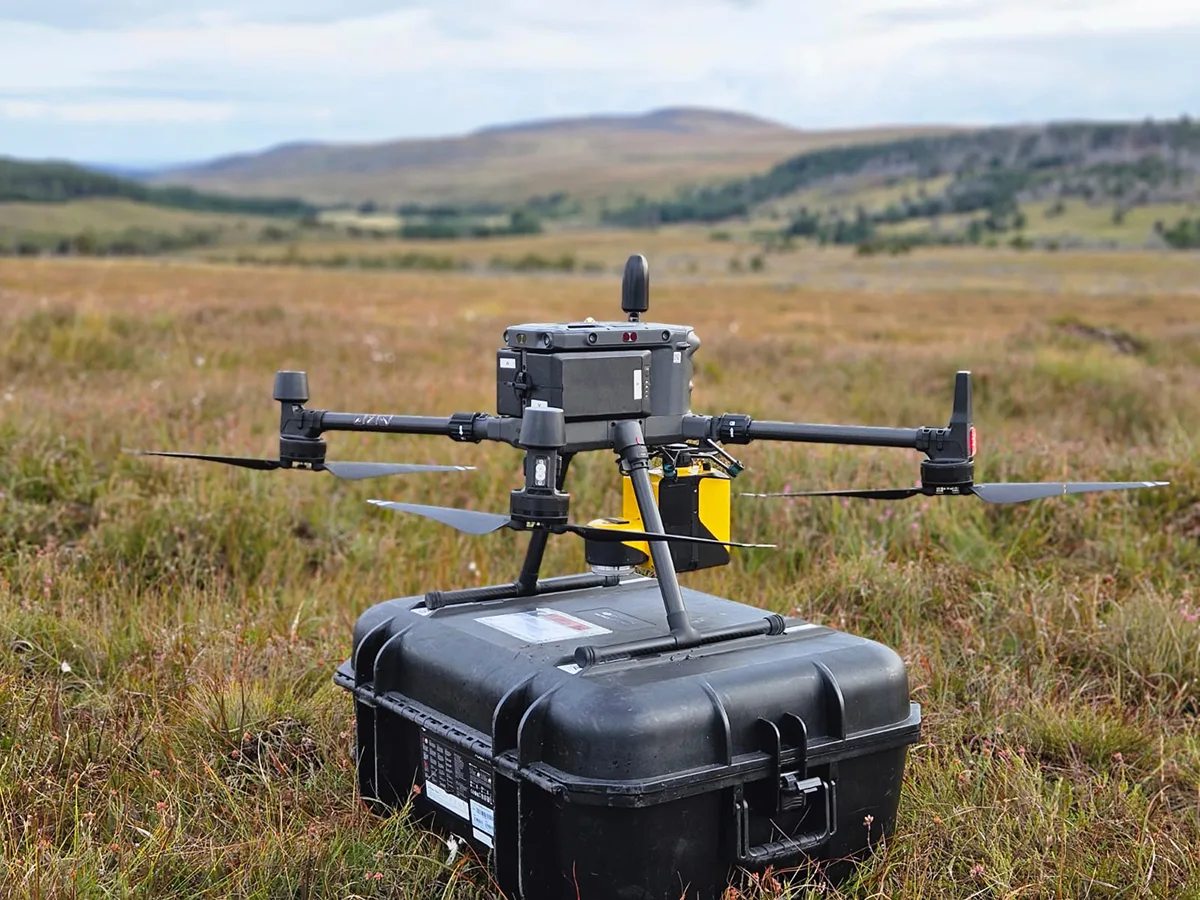
Whilst traditional survey methods offer the ability to interrogate features on the ground and capture details that may be hidden from view, remote sensing platforms can provide the perfect solution for large-scale topographic detail. The teams deployed a UAV (drone) with a LiDAR payload for this instruction.
Several flights were undertaken across the AOI and georeferenced using Post-Process Kinematic (PPK) workflows. Verification was undertaken using ground control and ground check grids to ensure compliance with the RICS accuracy banding requirements. UAV LiDAR was of particular use in this instance as the presence of livestock in many fields prevented our surveyors from safely gaining access.
In addition to the LiDAR dataset, approximately 3,000 images were collected with the same UAV payload. This allowed the post-processing of data to produce colourised point clouds and orthomosaic imagery.

Benefits of various survey techniques
Our teams could adjust their workflows to match the site characteristics by utilising various survey techniques. The improper use of remote sensing platforms, particularly in the drone market, can result in inaccurate data being provided to the client. We could provide the client with an accurate survey by having the training, qualifications and experience to seamlessly blend the traditional with the modern. Furthermore, the savings realised with mass-data capture can be passed on to the client.
There were some key benefits to this project:
- Safe and efficient collection of detailed information and data collection
- Accurate data from a survey of steep terrain, vegetated and inaccessible areas
- Contextually rich point clouds and imagery
- Holistic data sets
- Multiple deliverables from one survey
- Reduced need for site revisits
- Make better decisions with better data
- Enhanced accuracy
If you are looking for a topographic survey or land survey within agricultural land, construction projects, or any other location, please speak to us today - we'd be happy to help.