What is a Topographic Survey?
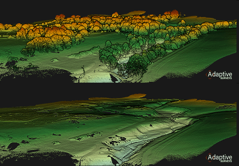
Topographic surveys, otherwise known as Topographic land surveys, are studies of the natural environment to determine visible features' size, orientation and position, and improvements on land such as buildings, roads, street furniture, service covers, and trees/vegetation.
Terrain measurements are also taken, which provide elevation grids and contours across an area, which is particularly useful to determine the flow of water across a site or to calculate how much material will have to be removed/added (cut/fill) during construction.

Following the site survey, we prepare a CAD plan of the site showing the surveyed features and ground model (contours and elevation grids) for use in various software design packages.
Why do you need a Topographic Survey?
Before a team can complete any design work, Land Surveyors must conduct a topographical survey (sometimes known as a land survey) for effective data collection. By measuring all the physical features of the area of interest, the design teams (typically consisting of Architects, Civil and Structural Engineers) can fully understand the land they are working with and tailor their designs accordingly. If you don’t have your site’s measurements, completing any designs reliably or with full confidence is impossible.
Are there different types of topographic surveys? And how accurate are topographic surveys?
There are many types of topographical surveys, and with technology continually evolving, new ways of surveying continue to develop.
Each methodology provides a different level of accuracy, and it’s essential to understand its limitations. Traditionally a surveyor will use a total station to collect measurements across the site. These instruments are accurate and can produce results in the +/-5mm range.
GNSS antennas, more commonly known as GPS antennas, are usually quicker than Total Stations but can produce accuracies in the range of +/-25mm.
The invention of drones and drone surveys has provided surveyors with many more tools for their toolboxes, and some drone payloads are capable of accuracies in the order of +/-30mm. Professional surveyors must take great care when instructing a drone survey as there are many different factors which can affect the achieved accuracy.

Lastly, Mobile Mapping is more frequently used now, which involves moving through a space or a route with a dynamic LiDAR device on a car or a backpack, for example, rapidly collecting spatial data. Accuracies can be in the order of +/-50mm with this technique.
How much do topographic surveys cost?
The cost of topographical surveys varies significantly, but the factors which make the most difference are the size and complexity of the area of interest and the accuracy to which the data is required. A large area with a high accuracy requirement will be more expensive than a small area with a low accuracy requirement.
Surveys can start from as little as £250 for a typical house extension land survey.
How do I instruct a land survey?
Speak to us today.
You can instruct a land survey simply and quickly through our Instruct a Survey form. Enquiries received before 3 pm will be responded to on the same business day. We deliver a topographic survey near you - speak to our team about your geo-location requirements.
Our surveyors will firstly need to understand the use case for the data - allowing the team to speak meaningfully about your required accuracies, tolerances and preferred data capture methodology to ensure that the final data and plans will be fit for purpose. Other aspects such as contour intervals, grid spacings and whether the data needs to be referenced to a national grid such as ordnance survey datum should be discussed and agreed upon before the surveyor mobilising.
Why should I employ a qualified Surveyor?
The Royal Institution of Chartered Surveyors regulates Adaptive Surveys. Our processes are designed to protect the client and ensure that every piece of work we submit is of the highest standard and quality. This gives our clients peace of mind that their instructions are being carried out efficiently, professionally, and to the standards a global compliance organisation sets.

Case Studies - learn more about our work: