This is probably the number 1 question we get asked by our clients. Whilst the answer isn’t straight-forward, we thought we would provide some guidance to those looking to instruct a drone survey or work with existing drone survey data.
How Does Drone Surveying Work?
To undertake a drone survey we firstly need some kind of sensor which will allow us to measure the geometry of our area of interest. Whilst the drone itself can provide some instructions to our payload such as when to start and stop recording, the drone doesn’t actually perform any survey tasks, it is merely a vehicle to transfer our sensor around our area of interest. Sensors typically come in two formats – RGB cameras and LiDAR (Light Detection and Ranging) sensors. Each type of sensor captures data in completely different ways using differing methodologies with each providing different datasets.
Photogrammetry
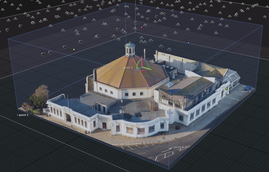
Photogrammetry is the art of taking multiple images with a camera across an area of interest and then creating 3D geometry based on the common points contained within. The process sounds complicated (and to be honest, it is!) however photogrammetry is an extremely useful tool in a surveyor’s toolbox. If you’ve come across drone surveys before then this is probably the type of survey you have seen.
The accuracy of a photogrammetric survey usually relates to a number called the Ground Sample Distance (GSD) which is measured in centimeters per pixel. Simply put, the lower this number, the higher the resolution of your data set. Accuracy depends on the GSD with a broad rule of thumb being 2x GSD horizontally and 3x GSD vertically. Therefore if you have a drone survey with a GSD of 2cm/px then you would expect accuracy to be 4cm horizontally and 6cm vertically. Having a lower GSD allows us to produce more accurate datasets however this will produce larger file sizes which can be difficult to handle.
LiDAR
This process works in a different way to photogrammetry. Instead of using a camera and post-processing software to determine your site topography, LiDAR uses a range-detecting sensor and a GNSS antenna (plus some fancy IMU sensors which we won’t go into here) to determine how far away features are for a given point in space. This might sound more complicated than photogrammetry but actually provides a more robust survey output. This is because instead of relying on software to analyse imagery and provide answers, we rely on physical measurements and proven GNSS technology.
The overall accuracy of a LiDAR system is very much dependent upon the accuracy of its individual components – LiDAR, IMU and GNSS. With multiple systems available and technology constantly improving, there is no fixed answer as to how accurate LiDAR is but generally speaking results of +/-30mm in horizontal and +/-50mm in vertical can be achieved with a mid-range sensor. Higher-accuracy systems are available however come at a significant cost increase for every 10mm gained in accuracy.

Survey Control
Irrespective of your chosen methodology, you will always need a control network across your site which has been measured with an independent technique such as GNSS or total station. This acts as a QA/QC tool to determine just how accurate your data is and without it there is no way to prove which tolerances have been met. A qualified surveyor will do this as a matter of course and can provide a table of observed error readings where requested. It’s important not to rely upon reports from processing software as these do not provide a true reflection of achieved accuracy.
LiDAR vs Photogrammetry, which one to use?
This depends on the type of site you are surveying. For bare-earth sites, photogrammetry will be able to provide you with an accurate, repeatable topographic survey however if your area of interest features vegetation then the only way to obtain true ground measurement is to deploy LiDAR. This is because photogrammetry can only survey what the sensor ‘sees’ which is the surface of vegetation. Where foliage obscures the ground, no readings can be determined. LiDAR is able to penetrate foliage to capture those readings missed by photogrammetry.
Conclusion
Drone surveys offer a rapid and cost-effective way to provide accurate topographic information across large areas. Whilst photogrammetry can offer a simple way to collect geospatial data, for full site coverage in difficult conditions it’s most likely that a LiDAR sensor will be required to provide true site topography. Irrespective of your use case, the most important thing to remember is that without independently installed ground control it will be impossible to verify the accuracy of your final model. Always insist upon receiving a table of achieved accuracy and discuss your requirements with the surveyor before they head out.
For more information about drone surveys talk to an expert at Adaptive Surveys.


