Client
Renewables Development
Delivery
May 2024
Project Type
Topographic Survey
Location
Dumfries & Galloway, Scotland
Scope
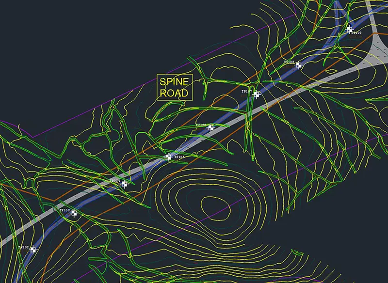
We regularly work with multi-disciplined teams throughout the UK, particularly in the field of onshore renewables development. One of our regular clients who undertake geotechnical investigations approached us to assist on a scope which included topographic survey deliverables. The Area of Interest (AOI) covered approximately 700Ha of mixed forestry, moorland and agricultural land in Dumfries & Galloway with areas of fencing and access tracks located throughout. Our brief was to provide topographic data on a 10m grid with watercourses, tracks and significant site features modelled in 3D DWG. The coordinate system was to be OSGB36 via OSTN15 and to ODN.

Solution
Having previously completed multiple projects across similar terrain, we had an appreciation for the challenges which this project would bring. Deploying personnel to cover such a large area on foot to collect data would not only take a significant amount of time, but also expose our teams to unnecessary risk. We therefore opted to deploy our UAV (drone) mounted LiDAR payload to collect vast amount of geospatial data in a relatively short period of time.
As with any survey, installing a control network is crucial in ensuring the final deliverables are in accordance with client requirements. Whilst UAV LiDAR can rely on RTK and PPK correction workflows the results will always need to be verified via ground-truthing and this is of particular relevance where the AOI includes differing terrain types. Using our Trimble R12i GNSS a team of 2 surveyors measured multiple physical features throughout the survey area including track edges, fence lines and watercourses. Additionally, check grids consisting of 40 points were measured in varying different terrain types. These would be used to determine whether the LiDAR had ‘penetrated’ the vegetation suitably to collect ground data.
After the control works were completed, our team planned multiple flight missions for our DJI M300 UAV using the survey area as a layer to ensure all areas were covered. After the completion of Point of Work Risk Assessments 15 flights were successfully completed and backed up to or cloud-based servers for onwards processing.
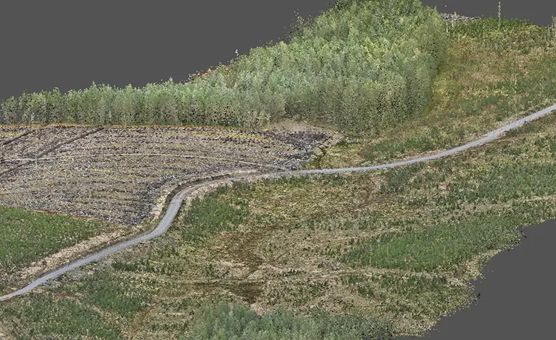
Once our team had demobilised from site, the LiDAR data was processed using PPK workflows to produce a colourised point cloud of the AOI. The data was cross-referenced with our control network to ensure compliance and topographic data was extracted in Trimble Business Centre. A 3D DWG file was then produced and refined in Autocad before being submitted to the client for review.

Benefits
Whilst UAV LiDAR methodologies can provide significant time and safety advantages over more traditional forms of surveying, their effectiveness relies almost solely on the inclusion of a robust control network. Errors in Post-Processing and Real-Time-Kinetic workflows are common and can only be identified when cross-referenced against measurements which are captured with other forms of survey. Combining the modern with the traditional allows us to benefit from the advantages of large-scale data capture whilst ensuring our client receives data which can be relied upon.
- Efficient data capture
- Removes survey teams from unnecessary risk
- Significant cost savings
- Holistic data deliverables
- Enhanced context provided via a colourised point cloud
